Having trouble locating the Costa Brava on the map? That’s actually pretty normal. It’s not a small or linear area, and it’s full of towns, coves, and stretches of coast and inland that make everything seem a bit chaotic at first glance. But don’t worry, once you understand how it’s organized, everything falls into place.
And that’s what this post is about: how to locate yourself on the Costa Brava, how to travel it without missing any of its most recognized spots, and how to discover many others that you may not have had on your radar, but that you can’t overlook.
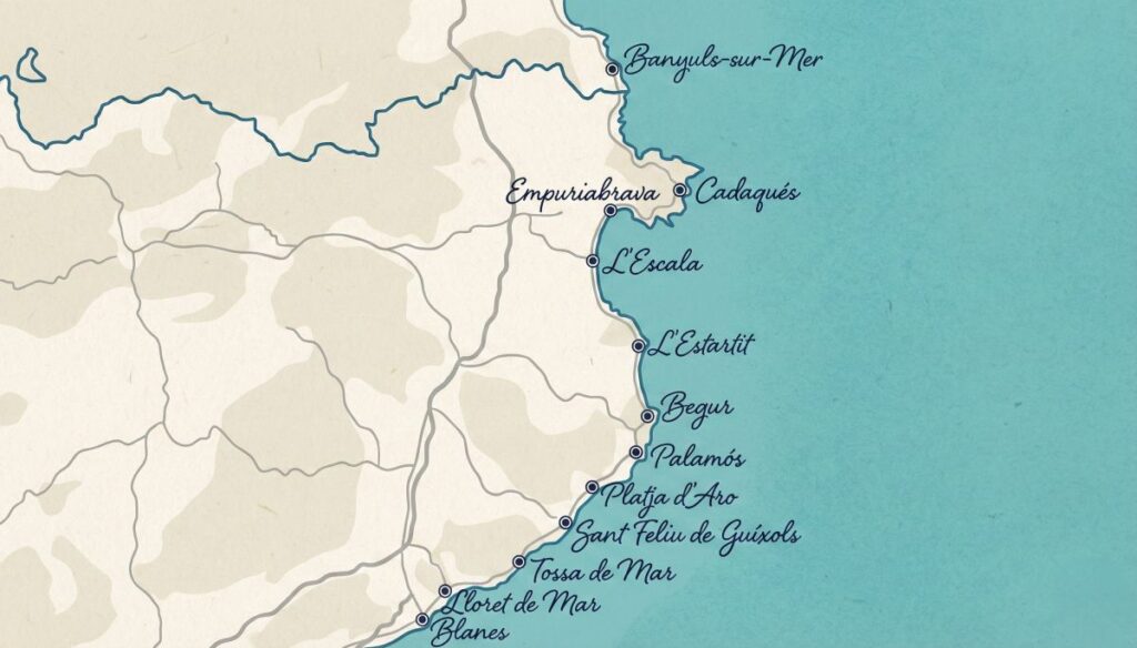
Where the Costa Brava map is and how it’s divided
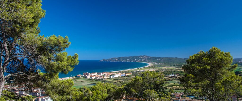
The Costa Brava stretches along the province of Girona, from Blanes to Portbou, right on the border with France. That’s more than 200 kilometers of coastline where beaches, coves, cliffs, fishing villages, and inland areas that are also worth a visit are mixed. That’s why looking at the map calmly is key to organizing the trip well and not ending up crossing the coast from end to end unnecessarily.
To better understand the map, the most practical thing to do is to divide the Costa Brava into three large areas: south, center, and north. This division is not official, but it works very well when planning routes and deciding where to stay.
South
It is the closest to Barcelona and also the most accessible. Here the towns are larger, there are huge beaches and many services, which makes it a very convenient area for a first contact. Some of the most representative towns in this area are Blanes, Lloret de Mar and Tossa de Mar.
Center
This partition is what many consider to be the most balanced. Here the picture-postcard coves, the coastal paths, and charming villages that sum up the Mediterranean essence very well begin to appear. In addition, it is an area where you can eat wonderfully.
Places such as L’Estartit, L’Escala and Begur stand out in this section, all of them very well located to explore coves and go on hiking trails.
North
And it’s the turn of the wildest! Here the landscape is more abrupt, the wind has more presence and the towns are smaller and quieter. You will find towns like Cadaqués, Roses and Llançà.
Towns on the Costa Brava map that you have to visit
If you look at the Costa Brava map calmly, you will see that it is dotted with towns with a lot of personality. Some are more seafaring, others more historical, others combine both… but all have something that makes them special. If you had to stay with just a few, these are the six on the Costa Brava town map —from south to north— that should not be missing from your route.
#1 Tossa de Mar
We start the list with Tossa de Mar, a must-see stop on your route, even if it’s just for an afternoon. Its walled old town, Vila Vella, makes it one of the most beautiful medieval sites on the coast.

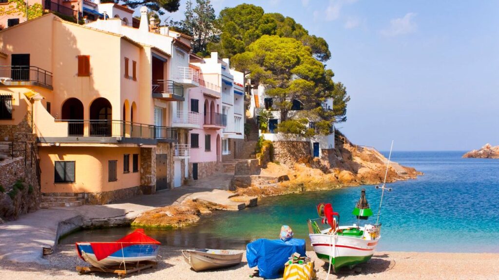
#2 Begur
Further north appears Begur —an inland municipality—, one of the most complete towns that we are going to recommend. It has a charming urban center that has a castle and one of the best viewpoints in the area: the Semàfor de Begur.
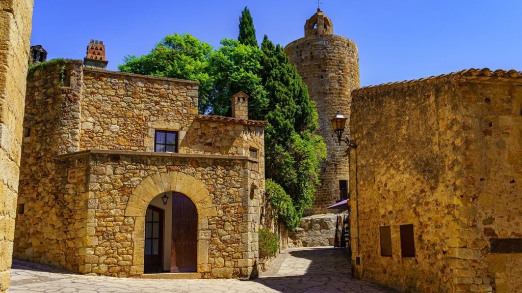
#3 Pals
And here is another inland town that makes the Costa Brava not only valuable for its coastline. Pals, with its perfectly preserved medieval historic center and the beautiful views of the Empordà, does not disappoint anyone.
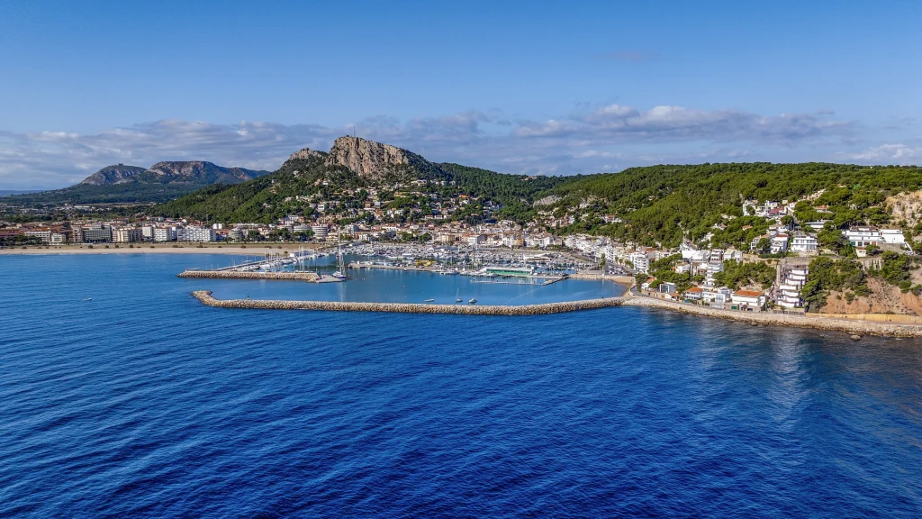
#4 L’Estartit
One of the best starting points for exploring the Costa Brava is in the center! It is a town very linked to the sea, with a family atmosphere and with a great protagonist: the Medes Islands. From here you can enjoy a large beach that bears the same name, snorkel or dive, walk along the promenade and enjoy a lot of plans to do in L’Estartit.
#5 L’Escala
Following the coast northwards, L’Escala appears, a town well known for its anchovies, but also for its beaches, its promenade and for being next to the ruins of Empúries.

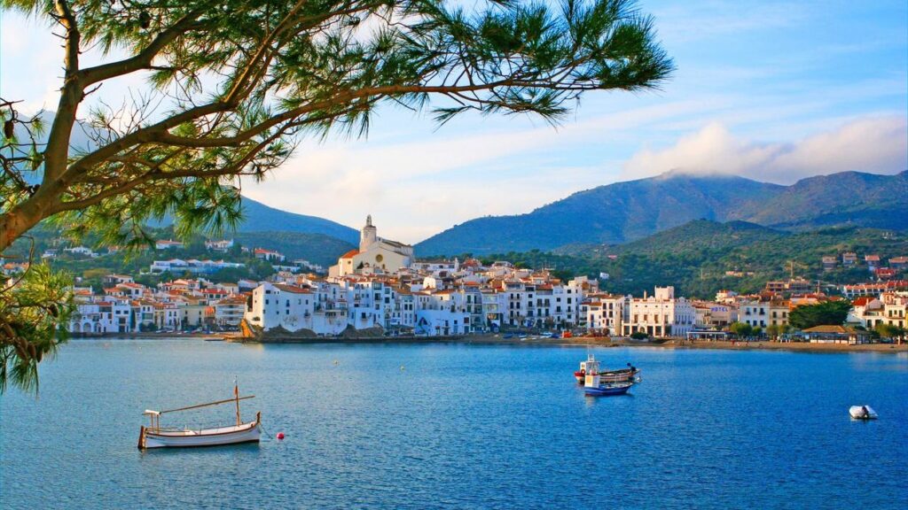
#6 Cadaqués
And at the very end, near France, is Cadaqués, an iconic municipality of the Costa Brava. Why? Because of its white houses and cobbled streets, which make the town have a charm that is difficult to match. Getting there is not the fastest thing in the world, but that is part of its magic.
Best beaches and coves on the Costa Brava map
As for beaches and coves, avoid improvising, because here we leave you the most spectacular and also the ones that are most worth visiting.
Beaches and coves on the map of the southern Costa Brava
One of the best known coves is Cala Pola, located a few minutes from Tossa de Mar. It is a sandy area surrounded by pine trees, with calm waters and quite accessible, ideal if you want to combine the beach with a getaway to the old town. Very close by is also Cala Giverola, between Tossa and Sant Feliu de Guíxols, perfect if you are staying in this area.
Beaches and coves on the map of the central Costa Brava
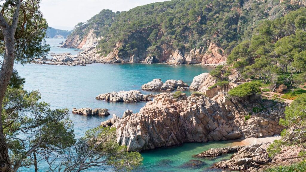
In the center of the Costa Brava, the map begins to fill with picture-postcard coves. Around Begur are concentrated some of the most famous, such as Cala Aiguablava, wide and with clear sand, or Cala Sa Tuna, small and with old fishermen’s houses on the seafront. Nearby, in the Calella de Palafrugell area, coves such as El Golfet or Cala Pedrosa stand out, wilder and reached by walking, ideal if you are looking for tranquility.
Following northwards, L’Estartit beach, next to the town of the same name, is one of the longest and most comfortable on the coast, with direct views of the Medes Islands. In the surroundings you will also find small coves within the Montgrí Natural Park, highly appreciated for snorkeling.
Beaches and coves on the map of the northern Costa Brava
Already on the northern Costa Brava, near Cadaqués, Cala Jugadora or Cala Culip stand out, within the Cap de Creus Natural Park. They are less accessible beaches, but with a spectacular environment. A little further south, near Roses, you will find options such as Cala Montjoi or Cala Jóncols.
A quick help to create your route with the map of the Costa Brava
If you want to get the most out of the Costa Brava map without spending half the trip in the car, the key is to choose where to stay well. The best? The center, at the height of L’Estartit .
Why? Because from here you have the southern and northern Costa Brava practically at the same distance. That allows you to improvise depending on the day, the wind or the plans you have noted.
In addition, finding accommodation around here is much easier than in other smaller and more remote towns, with options such as Apartamentos Estartit.
Come on, decide which one is going to be yours and make your route through the map of the Costa Brava in Spain a reality.